This is a site-specific conceptual art work that involves marking lines of latitude and longitude and their numerical coordinates on the ground, thus converting our everyday surroundings into a readable 1:1 scale map. The work reflects on the idea of location, and how our position is always relative to other places. Normally, these lines that we are used to seeing on maps - measured in degrees, minutes and seconds are many hundreds of miles apart but the smallest whole increment, 1 second, is only 20 to 30 meters in span . By inscribing the actual 1 second interval lines on the ground, we extract them from the abstract world of the 2D map and place them in an more intuitive and intelligible human context. This project tries to provoke viewers to look at their everyday surroundings in a fundamentally different way. The 1:1 map was staged on Windsor Ontario’s Riverfront Trail and on the Vancouver Seawall, with the assistance of the City of Windsor and the Vancouver Park Board.
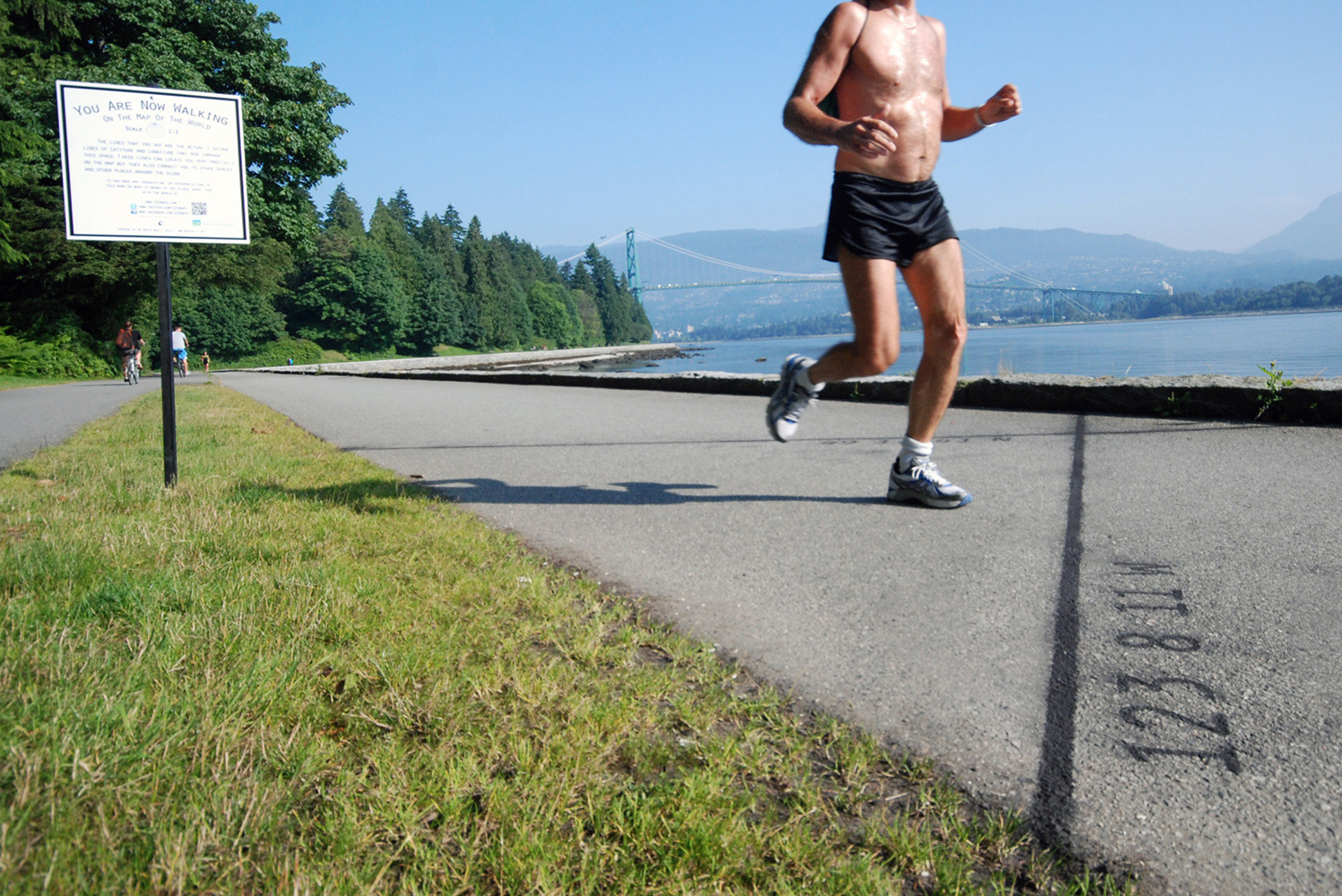
Ross Kelly The 1:1 Map of the World (Installation on the Vancouver Seawall), 2012, Signage and Black Chalk
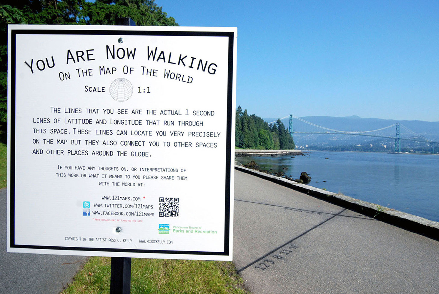
Ross Kelly The 1:1 Map of the World (Installation on the Vancouver Seawall), 2012, Signage and Black Chalk
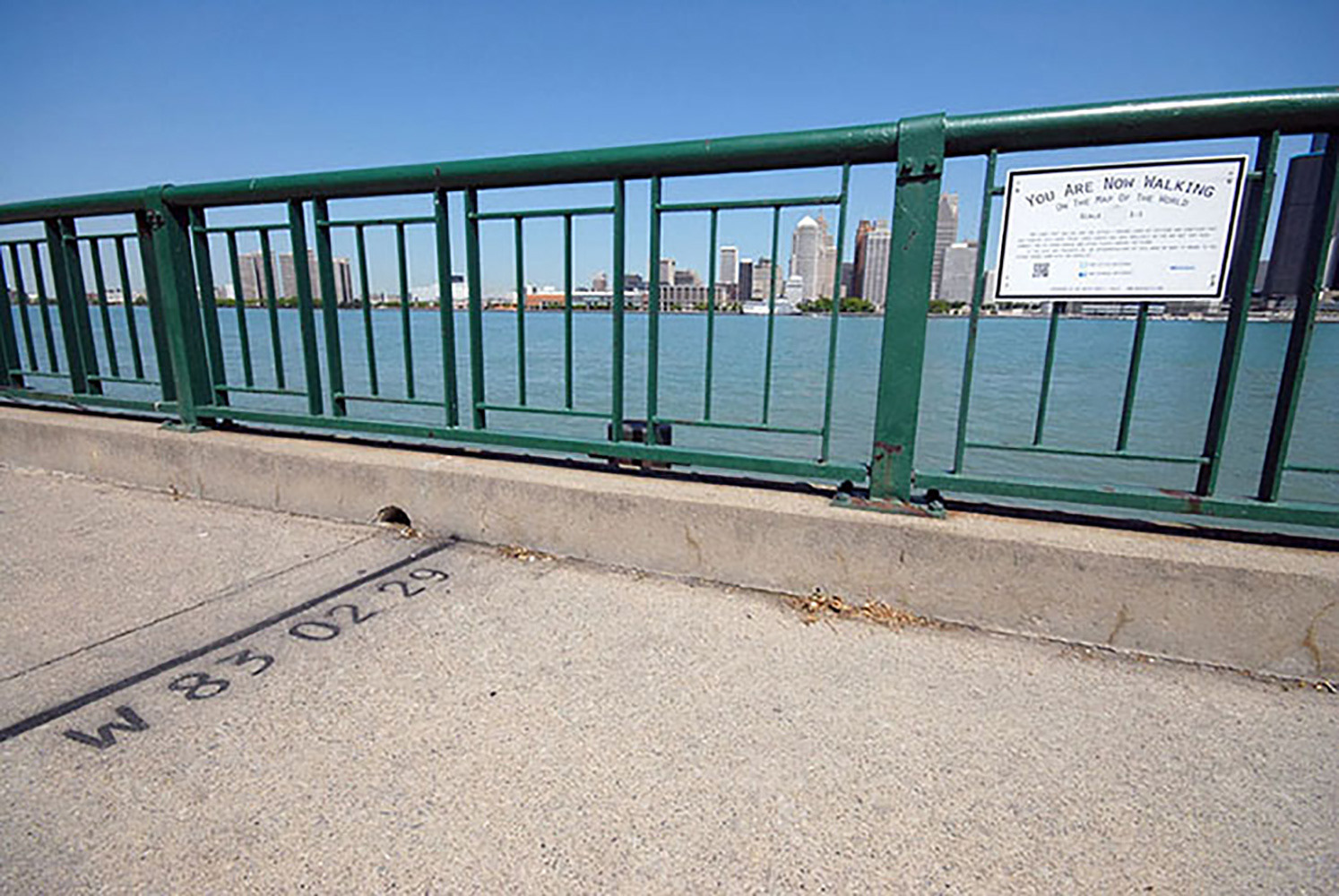
Ross Kelly The 1:1 Map of the World (Installation on the Detroit Riverfront, Windsor, ON), 2012, Signage and Black Chalk
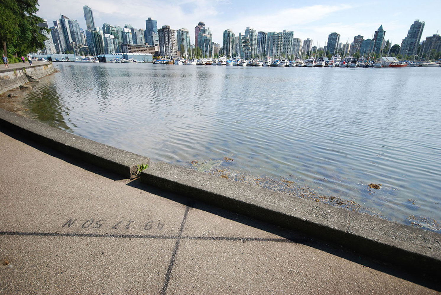
Ross Kelly The 1:1 Map of the World (Installation on the Vancouver Seawall), 2012, Signage and Black Chalk
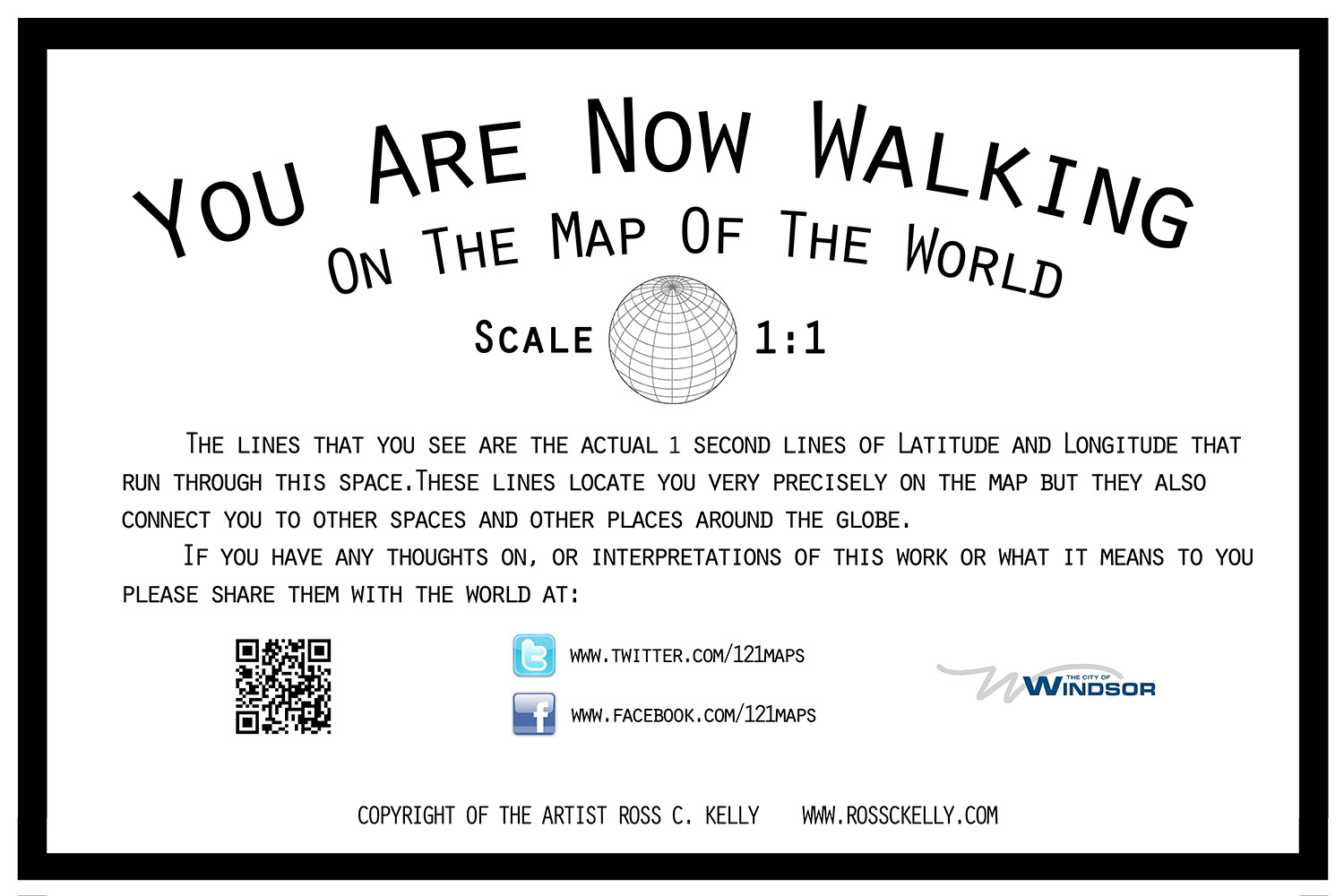
Ross Kelly The 1:1 Map of the World (Sign Detail Windsor ON), 2012, Coreplast and Vinyl